|
| |||||
| |||||
|
Our Getaways offer written Directions, Maps and suggested scenery, spanning Oregon and northern California; As with all the getaways on this site, the scenic viewpoints, hiking trails, etc., will keep expanding. The list for | |||||
|
Hwy 242 or the McKenzie Pass - Santiam Pass Scenic Byway. | |||||
|
The North Santiam Pass in the Cascade Mountains of Oregon: | |||||
|
The North Santiam River and Marion Creek on the Santiam Pass. | |||||
|
Hwy 242 or the McKenzie Pass - Santiam Pass Scenic Byway. | |||||
|
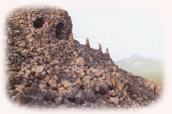
Summit at the McKenzie Pass - Santiam Pass Oregon Scenic Byway in the Cascade Mountains in Oregon. | |||||
|
Mt Washington in the Cascade Mountains from the summit. | |||||
|
North and Middle Sister from the summit, Viewpoint at the summit crossing the Cascades; Mt Jefferson in the distance. | |||||
|
The hiking trail to Proxy Waterfalls: the Lower Fall and the Upper Fall. | |||||
|
Unmarked Waterfall right after milepost marker 59 heading east on the | |||||
|
Autumn on the McKenzie Pass; Santiam Pass Scenic Byway. | |||||
|
The McKenzie River National Recreation Trail on the Wild and Scenic McKenzie. | |||||
|
Hike the Waterfalls Loop Trail on the wild and scenic McKenzie River, Koosah Waterfall; and Carmen Reservoir. Hiking upstream from Carmen Reservoir: A brief deviation from the Waterfalls Loop Trail, page 1, page 2, page 3, Koosah Waterfall from the other side of the McKenzie River, page 4, above Sahalie Waterfalls, page 5, upstream from Sahalie Waterfall, page 6, crossing the bridge above Sahalie Waterfalls, page 7 and powerful Sahalie Waterfall page 8. | |||||
|
Hiking on the McKenzie River National Recreation Trail in Autumn. | |||||
|
The south fork of the McKenzie River on the Aufderheide. | |||||
|
South fork of the McKenzie River on the "Aufderheide" in Autumn, French Pete hiking trail in the Three Sisters Wilderness, Roaring River, the wild and scenic north fork of the middle fork of the Willamette River, page 1 and page 2. | |||||
|
Protect our National Forests and Wilderness Areas. Leave NO Trace! | |||||
|
Protect our National Forests and Wilderness Areas. Leave NO Trace! | |||||
|
|
Forward ~ Travel Map for the Willamette Pass and the Umpqua Scenic Byway. Back ~ West Cascades National Scenic Byway, Map: USFS: The Willamette National Forest. USFS: Deschutes Ochoco National Forest. The West Cascades National Scenic Byway, 220 miles of unparalleled beauty, one vista after another: the Cascade Mountains, hiking trails, waterfalls, mountain lakes, old growth forests, spectacular lava | ||||
|
Travel Oregon and northern California while staying at Gathering Light ... a retreat located | |||||
|
|
You may want to bookmark this page before clicking these links. Travel to Gathering Light .... a retreat on the West Cascades National Travel to Gathering Light on the Willamette Pass, Hwy 58: Travel Directions to and Day Trips of about 100 miles from the retreat. Little known Scenic Places near the retreat: and Crater Lake |
||||
|
Contact Brad at Gathering Light ... a retreat. | |||||
|
| |||||